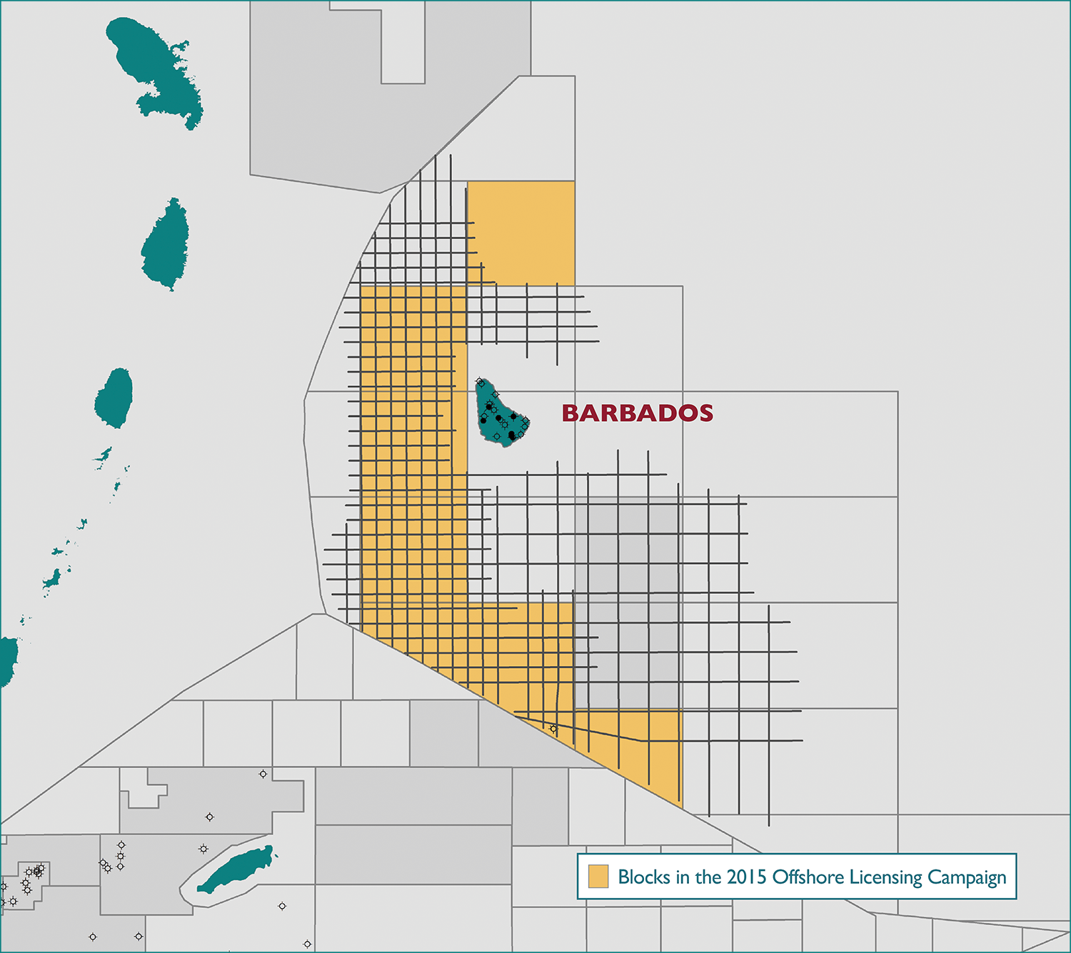
Offshore Barbados
22 June 2015MultiClient Geophysical (MCG) has in cooperation with the Government of Barbados acquired 6,837 km modern long-offset 2D seismic data in the most prolific parts of the Barbados Offshore License Area.
Regional evaluation and prospect mapping
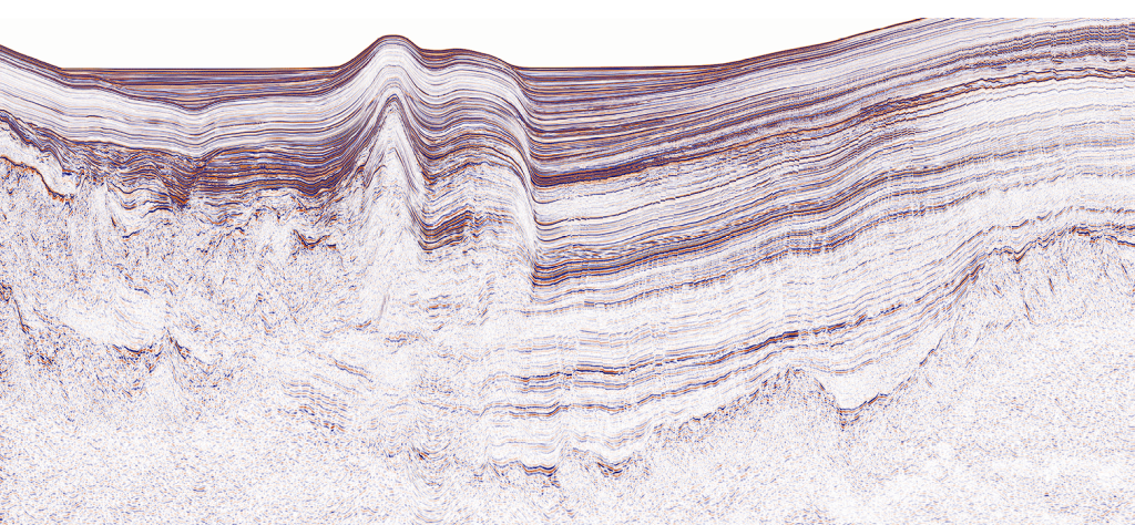
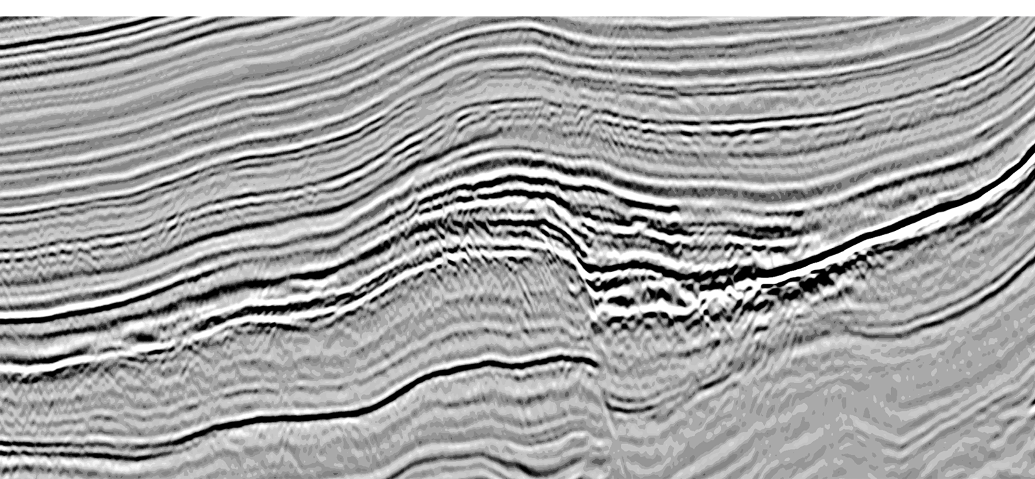
The MCG Barbados MC2D seismic dataset is a modern dataset for regional evaluation and prospect mapping of the very attractive Barbados offshore license area. The survey covers the Barbados Trough, the Tobago Basin and crosses the Barbados Ridge between the basins.
The data was acquired in 2012 and in 2013 in a 14 x 14 km and 7 x 7 km prospect grid, using a 10,500 m streamer, a 4,230 cu. in. energy source and 14 seconds recording length. The acquired data was then run through modern PSTM processing. In addition to the seismic data gravity and magnetic data is also available.
*Barbados 2015 Offshore Licensing Campaign Schedule of Events
Opening Date for Submission of Proposals from Pre-qualified companies | Jun 30, 2015 |
Period for Submission of Proposals from Pre-qualified Companies | Jun 30, 2015 – Dec 30, 2015 |
Closing Date for Submission of Proposals from Pre-qualified Companies | Dec 30, 2015 |
Evaluation of Proposals by Government’s Technical Evaluation Committee | Sep 30, 2015 – May 30, 2016 |
Selection of Successful Applicants and Invitation to Engage in Direct Negotiations | Sep 30, 2015 – Jun 30, 2016 |
*Click to download complete schedule of events (.pdf)
Please see the Government of Barbados’ official webpage for more information about the Barbados 2015 Offshore Licensing Campaign. (http://energy.gov.bb/2015Licensing/)
Click to download MCG flyer (.pdf)
Click to download map of Barbados Offshore Licensing Round Bid Blocks (.pdf)
Please contact us for more information
- Kenneth Mohn kenneth.mohn@mcg.no
- Tom Wolden tom.wolden@mcg.no
- Tor Åkermoen tor.akermoen@mcg.no
- Lars Ivar Leivestad lars.ivar.leivestad@mcg.no
- John Whitcomb john.whitcomb@mcg.no